How to know if your land has been cleared
"Cleared" is a real, physical change to the ground — brush and trees removed, the surface scraped or reshaped — and it is exactly the kind of thing you can see in a photo from above, if you have two photos far enough apart to compare. Here is what that actually looks like, on a real parcel, and how to check your own.
The short version.
- Draw a box around your parcel and AcreDog pulls a real, dated aerial or satellite photo of it — free, no account.
- If it's farmed cropland, we can also compare this growing season against its earlier seasons and tell you plainly if the ground stopped reaching full green cover, which is consistent with land coming out of production.
- If it isn't farmed — brush, pasture, timber, anything that was never a crop — we still show you the real before/after photo. We don't guess at what happened on ground we were never watching for a crop; the reading is yours to make.
What real clearing actually looks like from above
This is a real example, not a mock-up: the same 183-acre demo parcel in Box Elder County, Utah used throughout these guides, in every government aerial flight on file — five captures across ten years, 2011 to 2021, all brightened on one shared scale so a frame that looks greener than another really was.
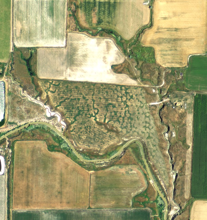
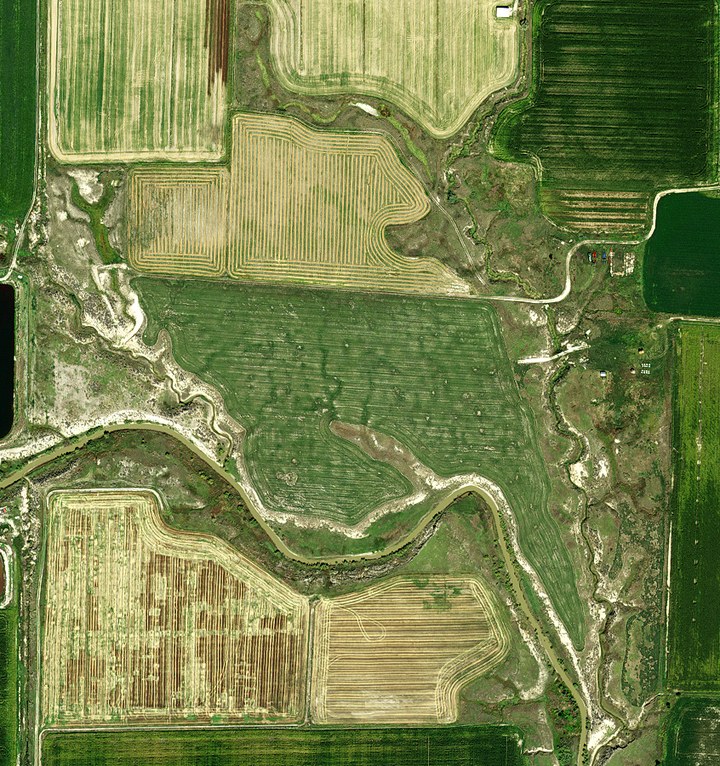
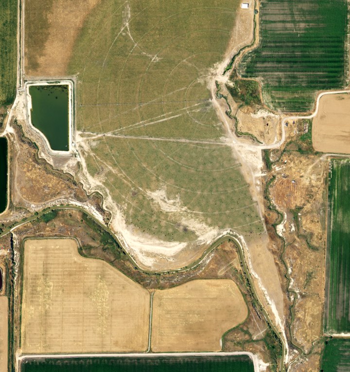
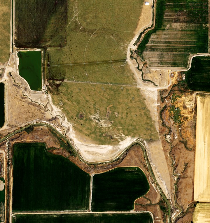
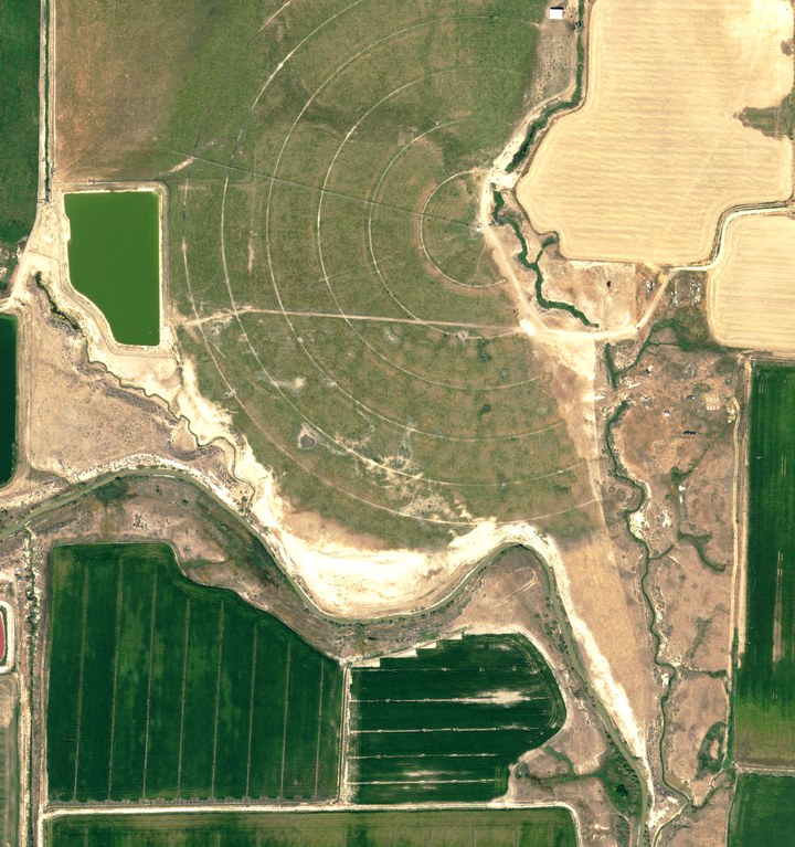
To be plain about what we do and don't know here: these are five real, dated photos of one real parcel, and the ground visibly changed across them. We do not know who cleared it or why — most likely an ordinary farm build-out, nothing more. What the whole record does settle is when: the brush in the middle was gone by August 2014, and the reservoir and center pivot were in by July 2016. The brush along the creek itself never went — the clearing was the field, not the waterway. An earlier version of this page showed only the first and last frames and said it could not tell when in the decade this happened; checking every flight on file is what answered that, and it is the same standard we hold our own verdicts to. And from orbit, the same ground has reached green every growing season since 2017 — the first year the satellite record covers — across 494 clear passes, measured the way our verdicts are (the whole 183 acres at once, several fields together).
What AcreDog can tell you about your own land
The example above is the extreme case — a decade apart, about as dramatic as this gets. Most of the time you're checking something more recent and more specific: did anything change since I last looked? The answer depends on what your land actually is.
Farmed cropland
We compare peak greenness across several growing seasons, not a single snapshot — a hayfield looks bare for a couple of weeks after every normal cutting, and a single photo can't tell that apart from land that actually stopped being farmed. If your land reached full canopy green in its earlier seasons but not this one, we say so plainly: consistent with land coming out of production, not just a cutting or a dry spell.
Why one photo isn't enough, with the pictures to prove it: we checked three real fields against 1,190 real satellite passes over ten years, and a same-week comparison would have cried wolf 13 times. See ten years, three fields.
Everything else — brush, pasture, timber, raw ground
Most land someone worries about clearing on isn't a crop field, and we don't pretend otherwise. On ground that was never farmed, we don't issue an automated verdict at all — there's no crop baseline to compare against. What you get instead is the real before/after photo itself, dated, so you can look and decide for yourself. For a non-farm owner that's arguably the more useful thing anyway.
Where this doesn't help
- Nothing free is live. The example above spans ten years because that's how far apart NAIP's own flights over that ground happen to fall — NAIP re-flies each state on a 2–3 year rotation, not on demand. A clearing that happened last month may not show up in a sharp photo until the next flight reaches your county.
- The recent satellite pass is coarse. Sentinel-2 updates every few days, but each pixel covers about 100 square metres — half a tennis court — averaged into one colour. A clearing large enough to change a visible patch of the field will show up; a single tree, a narrow strip, or a thinning that leaves most of the canopy in place will not. See what a satellite can and cannot see for the full size breakdown.
- We report ground cover, not intent. A photo can show you that brush became bare ground. It cannot tell you whether that was authorized, and neither can we.
Check your own land
The parcel above is one example. Draw a box around yours and get the same real, dated look — free, in about a minute.
See the example above, then draw your own →
That link opens straight onto the parcel shown above so you can see it move before you draw your own. Right-drag a box around your ground — no login to look, and none needed to leave a watch email either, until you want to manage it from a dashboard later.
AcreDog watches rural parcels from public satellite and aerial imagery for owners who cannot easily drive out to them. We publish what the instrument can and cannot do because a monitoring service you cannot calibrate your trust in is worse than none. More on what this product is and is not, or read the full breakdown of what a satellite can and cannot see, how to check on land you own out of state, or how to see satellite images of your property. All AcreDog guides →