How to see satellite images of your property
There are a handful of real, free ways to do this today, and they're not equally good for the same question. Here's what each one actually gives you, honestly compared, and where each falls short.
The short version. Google Maps and Google Earth are the fastest way to look at your land, but the imagery is a blended composite with no capture date shown anywhere. Your county's GIS site sometimes has a real, dated aerial photo, but coverage and quality vary enormously by county. The US Geological Survey's own archive has the actual source imagery, dated and free, but it's built for GIS professionals, not a quick look. AcreDog draws your exact parcel and hands you a real, dated photo — free, one click, no account.
The free ways people already try this
Google Maps / Google Earth
The fastest way to look at almost any piece of ground on the planet, and genuinely useful for orientation — roads, structures, the shape of a field. The catch is the date. Google's satellite layer is a composite stitched together from many different passes, and the standard map view gives you no way to tell when any given patch of ground was actually photographed. It might be recent. It might be several years old. Nothing in the interface tells you which, and it can change without notice as Google refreshes the mosaic.
Your county assessor's GIS site
Many counties publish their own aerial imagery, tied to parcel boundaries, which is often the most direct way to see your exact legal parcel rather than an approximation. Quality and recency depend entirely on that county's own flight budget and schedule — some are excellent and current, many are clunky and several years behind, and there's no way to know which you're getting until you look.
USGS EarthExplorer, direct
The actual source data — the same NAIP aerial imagery this page uses — free, public, and precisely dated down to the flight. It's also built for people who already know what a scene ID is and own GIS software to open a GeoTIFF in. Genuinely the most complete public archive, and genuinely not a "look at my land in the next minute" tool for most people.
What a dated, compared photo actually looks like
Here's a real example: our own demo parcel, 183 acres in Box Elder County, Utah. Both of these are real, both are free, and both tell you exactly when they were taken.
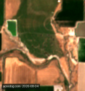
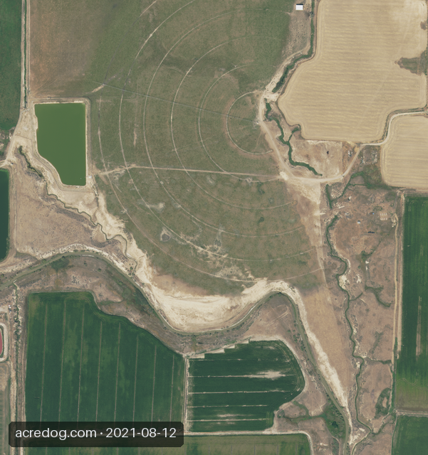
No blended mosaic, no GIS software, no county lookup. The date is on the picture because a picture without one is a claim you can't check.
Where this doesn't help
Worth saying plainly, since overselling this is exactly the failure mode the tools above already have.
- Nothing free is live. The freshest satellite pass is typically days to a couple of weeks old. If you need to know what happened on a specific afternoon, no public imagery — here or anywhere — will tell you that.
- The sharp photo lags the recent one. The 1-metre aerial detail sharp enough to see a structure or a fence line is usually a year or more old. You are always trading recency for detail; nothing free gives you both in the same frame.
- A small feature can be invisible on the recent pass. At 10 meters a pixel, anything smaller than roughly half a tennis court is averaged into the ground around it rather than shown.
See your own land
The example above is one parcel. Draw a box around yours and get the same pair — a recent dated photo and the sharpest one on file — free, in about a minute.
See the example above, then draw your own →
That link opens straight onto the parcel shown above so you can see it move before you draw your own. Right-drag a box around your ground — no login to look, and none needed to leave a watch email either, until you want to manage it from a dashboard later.
AcreDog watches rural parcels from public satellite and aerial imagery for owners who cannot easily drive out to them. We publish what the instrument can and cannot do because a monitoring service you cannot calibrate your trust in is worse than none. More on what this product is and is not, or read the full breakdown of what a satellite can and cannot see or how to check on land you own out of state. If you go on to watch land from here, how we avoid false alarms shows the real evidence behind the alerts — ten years of real passes over three real fields. All AcreDog guides →