How to check on land you own out of state
You don't need to fly out, call a neighbor and hope they look closely, or pay someone to drive by. You need a real, dated photo of the ground — and that's a box on a map away, not a trip.
The short version.
- Draw a box around your parcel on a map. If you don't have the exact corners memorized, your county assessor's GIS site or your deed will have them — or just draw roughly around where you know it to be.
- You get a real satellite photo from the last few days, and the sharpest aerial photo ever flown over that ground, side by side. Free, no account, about a minute.
- If you want to stop checking by hand, leave an email and we recheck it on a schedule — you only hear from us when the ground itself changes.
Why this beats the usual options
Everyone who owns land they can't easily get to ends up trying one of the same three things, and each has the same problem.
- Calling a neighbor or a tenant. You get their read on it, filtered through however closely they happened to look, on whatever day they happened to think of it. No date, no photo, nothing to compare next time.
- Driving out yourself. Works, and costs a day and a tank of gas every time you want to know something you could have checked from a phone.
- Hiring an inspection. Real information, real cost, and usually more than a "is anything different" check is worth.
A dated photo doesn't replace any of these when you genuinely need a person on the ground — a legal dispute, a boundary question, a structure to inspect. What it replaces is the routine check: has anything changed since I last looked. That one you can answer yourself, for free, without leaving your chair.
What you actually see
Here's a real example — our own demo parcel, 183 acres in Box Elder County, Utah. This is exactly what you'd get for your own land, the first time you draw it.
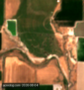
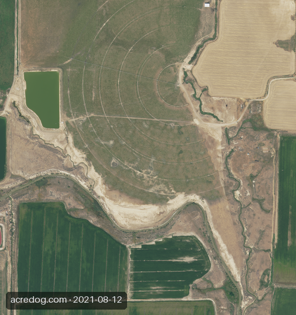
Both real, both free, dated on the picture. Nobody drove out for either one.
What this does and doesn't tell you
Worth being direct about, since it's the whole reason to trust the answer at all.
It tells you the ground itself, not events on it
Whether it's green or bare, cleared or grown over, changed shape or stayed put — real, physical, visible-from-above facts. It will not tell you who did something or when, down to the day. A satellite photographs; it doesn't watch.
The recent photo is coarse; the sharp photo is old
The imagery that arrives every few days is 10 meters a pixel — a truck, a person, a single dumped load is invisible on it, averaged into the ground around it. The imagery sharp enough to see that kind of detail is aerial, and it's typically a year or more old, sometimes several. You are always trading one for the other; nothing free gives you both at once.
If you leave an email, know what triggers it
The scheduled recheck alerts on a real change in ground cover between growing seasons — green to bare, or back. It does not alert on every difference a photo would show, and on ground that isn't cropland it makes no green/bare call at all. It's built to stay quiet rather than guess, which means real events smaller than the whole parcel can pass without a word.
Doing it for your own land
The example above is one specific parcel. Yours will look different and that's the point — draw the box around it and see for yourself.
See the example above, then draw your own →
That link opens straight onto the parcel shown above so you can see it move and zoom before you draw anything. From there, right-drag a box around your own ground — no login needed to look, and no login needed to leave a watch email either, until you want to manage it later from a dashboard.
AcreDog watches rural parcels from public satellite and aerial imagery for owners who cannot easily drive out to them. We publish what the instrument can and cannot do because a monitoring service you cannot calibrate your trust in is worse than none. More on what this product is and is not, or read the full breakdown of what a satellite can and cannot see. If you go on to watch land from here, how we avoid false alarms shows the real evidence behind the alerts — ten years of real passes over three real fields. All AcreDog guides →