How land changes in Box Elder County, UT
Real imagery of one parcel in Box Elder County, about 10 years apart — the kind of change AcreDog watches for on any US property.
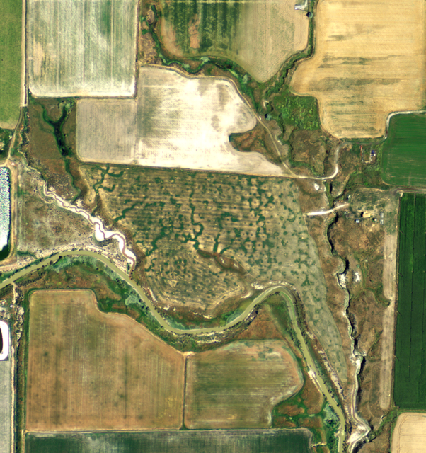
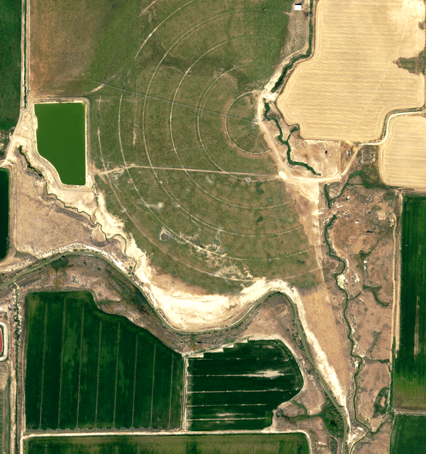
about 10 years apart, real high-detail aerial (NAIP) imagery of the same ground in Box Elder County, UT.
See this on the map, then draw your own parcel →AcreDog compares real satellite and aerial imagery of any US parcel, free, and emails you when the ground cover on farmland changes between growing seasons. On ground that isn't farmland we don't issue a crop verdict at all — you get the before/after and the reading is yours to make. This page shows one real example in Box Elder County, not a stock photo.